Managing large-scale events and exhibitions has grown increasingly complex as venues expand and attendee expectations rise. Accurately capturing and documenting vast, dynamic spaces—whether for planning, logistics, or post-event analysis—remains one of the most persistent challenges organizers face. Traditional measurement methods fall short when dealing with sprawling convention centers, multi-hall exhibitions, or outdoor festival grounds that shift configurations daily. This is where 3D LiDAR scanning emerges as a transformative technology. Originally a cornerstone of real estate documentation and spatial data collection, LiDAR has found powerful new applications in the events industry. By delivering millimeter-level precision and rapid data acquisition, 3D LiDAR scanners enable organizers to create comprehensive digital twins of entire venues in a fraction of the time manual methods require. The efficiency gains are substantial, but the real value lies in what becomes possible: high-resolution scanning that captures every architectural detail, and automatic data stitching that seamlessly maps large-scale spaces from multiple scan positions. This guide explores how event professionals can harness these capabilities to elevate their spatial documentation and planning workflows.
Understanding 3D LiDAR Scanners for Real Estate and Event Applications
A 3D LiDAR scanner works by emitting rapid laser pulses that bounce off surrounding surfaces, measuring the time each pulse takes to return. These millions of individual measurements generate a dense point cloud—a three-dimensional digital representation of the scanned environment accurate to within millimeters. While 3D LiDAR scanners for real estate have become standard tools for property documentation and virtual walkthroughs, their capabilities translate remarkably well to event capture scenarios. Convention halls, exhibition floors, and outdoor festival grounds present the same spatial complexity as commercial real estate, often at even greater scale. For event organizers, the technology addresses three critical needs simultaneously. First, accuracy: every structural element, from rigging points to emergency exits, is captured with survey-grade precision. Second, speed: modern scanners can document tens of thousands of square meters in hours rather than days. Third, adaptability: whether scanning a permanent arena or a temporary pavilion structure, LiDAR performs consistently regardless of lighting conditions, crowd density during off-hours, or surface materials. This combination makes it indispensable for professionals who need reliable spatial data under demanding timelines.
The Advantages of High-Resolution Scanning for Exhibitions and Events
High-resolution scanning fundamentally changes what event professionals can achieve with spatial data. When a LiDAR scanner captures an exhibition hall at its maximum resolution, the resulting point cloud preserves details down to individual booth fixtures, cable runs along ceilings, and subtle floor gradients that affect equipment placement. This granularity transforms several critical workflows.
For exhibition layout planning, high-resolution data allows designers to place booths, signage, and installations with absolute confidence that everything fits. Rather than relying on outdated floor plans or approximate measurements, teams work from a precise digital replica where every column, doorway, and utility access point is exactly where it appears. This eliminates costly on-site surprises during setup—a misaligned booth wall or an overlooked structural beam can derail an entire installation schedule.
Virtual tours and remote collaboration benefit enormously from detailed scans. Stakeholders who cannot visit the venue in person can navigate a photorealistic 3D model, making informed decisions about sponsor placements, traffic flow, and accessibility without requiring additional site visits. For international exhibitions where organizers coordinate across time zones, this capability alone justifies the scanning investment.
Post-event analysis gains new depth when organizers compare pre-event scans with post-event conditions. Damage assessment becomes objective rather than disputed, and spatial usage patterns inform future layout optimizations. Event spaces that host recurring shows benefit from a growing archive of high-resolution scans, each one refining the organizer’s understanding of how attendees interact with the physical environment. The cumulative effect is measurably better visitor experiences and more efficient use of available space with each successive event.
A Step-by-Step Guide to Implementing 3D LiDAR Scanning for Event Spaces
Successfully deploying LiDAR scanning at a large-scale event requires deliberate planning that accounts for the unique constraints of live venues. Unlike scanning a static property, event spaces involve tight turnaround windows, active construction zones, and coordination with multiple vendor teams. A structured approach ensures you capture comprehensive data without disrupting critical setup timelines.
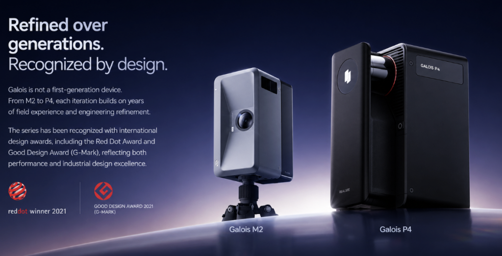
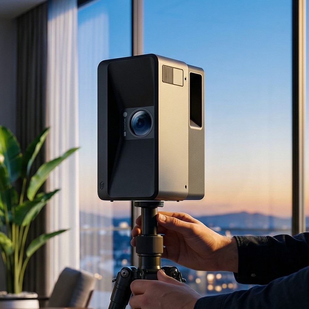
Choosing the Right Scanner: Spotlight on Galois P4
Scanner selection should prioritize portability, scan speed, and registration accuracy—three factors that determine whether a device can handle the demands of event environments. The Galois P4 stands out for event professionals because it combines lightweight construction with the range needed to capture cavernous exhibition halls from fewer scan positions. Its rapid capture cycle means operators spend less time at each station, covering more ground during limited access windows. Compared to heavier terrestrial scanners that require extensive setup at each position, the Galois P4’s streamlined workflow reduces total project time significantly. For teams scanning outdoor festival grounds or multi-level conference centers, this efficiency translates directly into fewer crew hours and less interference with vendor operations happening simultaneously.
Planning and Executing the Scan for Optimal Results
Begin with a pre-scan site walk to identify optimal station placements, noting areas where line-of-sight obstructions—temporary walls, staging equipment, or suspended rigging—might create coverage gaps. Schedule scanning during low-activity periods, typically early morning or late evening during build days, when foot traffic is minimal and temporary structures are stable. Coordinate with venue management to ensure doors remain open and lighting conditions won’t shift mid-scan. On-site, work systematically from the venue perimeter inward, maintaining consistent overlap between adjacent scans of at least thirty percent. Station your operator team in pairs when possible: one managing the scanner, the other documenting station numbers and noting any transient objects that may need filtering from the final dataset. This disciplined execution produces clean, complete point clouds ready for processing.
Mastering Automatic Data Stitching for Large-Scale Space Capture
When scanning a venue that spans tens of thousands of square meters, a single scanner position captures only a fraction of the total environment. Automatic data stitching solves this by algorithmically aligning overlapping point clouds from dozens or even hundreds of individual scan positions into one unified, dimensionally accurate 3D model. The software identifies common geometric features between adjacent scans—wall edges, column profiles, floor transitions—and calculates the precise spatial relationship between each capture point. For event organizers working under pressure, this automation eliminates what was once a painstaking manual registration process that could consume days of specialist labor.
The practical impact is significant. A complete exhibition center scan comprising eighty or more stations can be registered into a cohesive model within hours of data collection, giving planning teams same-day access to a navigable digital twin. Errors that plague manual alignment—accumulated drift, mismatched reference points, or rotational offsets—are minimized through iterative optimization algorithms that refine the global alignment until residual errors fall below acceptable thresholds. Platforms developed by PropTech companies like Realsee have advanced the processing of spatial data into interactive digital twins, making it easier for event teams to visualize and share unified 3D models across stakeholders. To ensure smooth stitching in dynamic event settings, operators should maintain generous overlap between stations, avoid scanning during active construction that changes geometry between captures, and place recognizable geometric targets in transitional zones like hallways connecting separate halls. These precautions give the stitching algorithm strong anchor points, producing seamless models that accurately represent even the most complex multi-zone venues.
Practical Solutions and Best Practices for Event Organizers
Budget constraints represent the most common barrier to adopting LiDAR scanning for events, but the calculus shifts when organizers account for costs avoided. A single scanning session that prevents booth misalignment during a major trade show saves more in emergency labor and delayed openings than the scanning investment itself. For organizations hosting recurring events, amortizing scanner costs across multiple uses—or partnering with scanning service providers for project-based engagements—makes the technology accessible without capital equipment purchases.
Tight schedules demand that scanning integrates into existing workflows rather than competing with them. The most effective teams treat scanning as part of the venue handover process, capturing baseline conditions immediately after gaining access and conducting a final verification scan once build-out reaches completion. This bracketing approach provides both a planning foundation and an as-built record without requiring dedicated schedule blocks that disrupt other operations.
Integrating scan data with event management software amplifies its value considerably. Point cloud exports can feed directly into CAD platforms where designers refine booth layouts, or into BIM environments where structural and MEP coordination happens. Training two or three staff members on scanner operation and basic data processing creates internal capability that eliminates dependency on external consultants for routine captures. These trained operators develop institutional knowledge about optimal station placement for specific venues, improving data quality with each successive event. Organizations that archive their scans systematically build a spatial intelligence library—venue-specific datasets that accelerate planning timelines from weeks to days as teams reference proven configurations rather than starting from scratch. The compounding returns make early adoption a strategic advantage that widens over time.
Leveraging LiDAR Scanning as a Strategic Advantage for Event Professionals
3D LiDAR scanning has moved well beyond its origins in real estate documentation to become an essential capability for large-scale event capture. The technology delivers what event professionals need most: survey-grade accuracy across expansive venues, rapid data acquisition that respects tight production schedules, and adaptability to environments ranging from permanent convention centers to temporary outdoor installations. High-resolution scanning provides the granular spatial detail that transforms planning from approximation into precision, enabling confident decision-making about layouts, logistics, and visitor flow. The implementation process, while requiring deliberate planning around scan timing and station placement, becomes straightforward with purpose-built tools like the Galois P4 that prioritize portability and speed without sacrificing data quality. Automatic data stitching ties everything together, converting dozens of individual captures into unified digital twins that teams can access within hours of scanning. For organizers ready to move beyond outdated floor plans and manual measurements, adopting LiDAR scanning represents not just a technological upgrade but a fundamental shift in how spatial intelligence drives better events. Those who invest early build compounding advantages—deeper venue knowledge, faster planning cycles, and consistently superior attendee experiences—that strengthen with every event captured.